Read about new exciting cartographic features in QGIS and how they'll improve your maps here.
Archive: Cartography
- Check out these 15 practical cartography tips to use in ArcGIS Pro.
- Looking to create extra pretty shaded relief or to start using Blender in your cartography projects? Make sure to check out this thorough tutorial.
- Curious about annotations in QGIS? Check out this deep-dive workshop.
- The Maki map icons (CC-0) from Mapbox are now converted to parameterized point markers and available to download for QGIS from the Style Hub. Take a look at the markers and all the other styles here.
- Looking for icons or other graphics for your map? Iconduck is a project to make open source icons and illustrations more accessible. Check it out here.
- The GeoDataViz Toolkit is a set of resources that will help you communicate your data effectively through the design of compelling visuals. Check it out here.
- Check out these tricks for visualizing ocean depths in ArcGIS Pro. Learn how to combine blend modes, hillshade and slope raster functions, and custom color schemes to customize a bathymetry DEM.
- The mapsf R package helps to design various cartographic representations such as proportional symbols, choropleth or typology maps. Here is a cheat sheet guiding you in using mapsf.
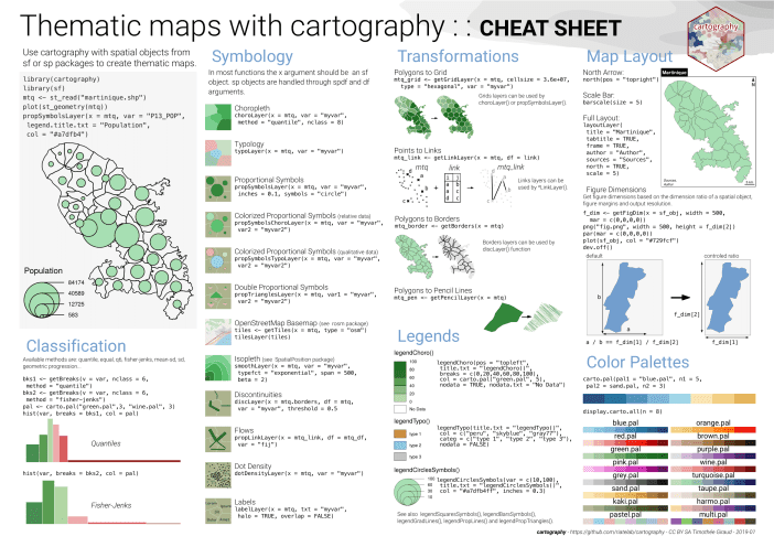
- The cartography R package helps to create thematic maps with the visual quality of those built with a classical mapping or GIS software. Here is a cheat sheet guiding you in using cartography.