This post describes the process of turning a raster dataset into a SpatioTemporal Asset Catalog (STAC) object using Python.
Archive: Tutorials
- Here is a detailed guide on how GraphHopper's functions and algorithms can cover different use cases and how this affects the setup at scale.
- This post discusses some of the differences between AMD and ESM, and includes a hands-on tutorial to help you build your first ESM project with Vite and the ArcGIS API for JavaScript.
- This post shows you how to access public Google Earth Engine assets, view and analyze them, and save as a portable GeoTIFF format using only the terra R package.
- Want to learn more about satellite imagery? Here you can find tutorials, user guides and examples of how you can use satellite imagery to analyze various phenomena and events around the globe.
- Google Earth Engine and BigQuery are both tools on Google Cloud Platform that allow you to interpret, analyze, and visualize geospatial data. This post demonstrates how data can be moved to BigQuery.
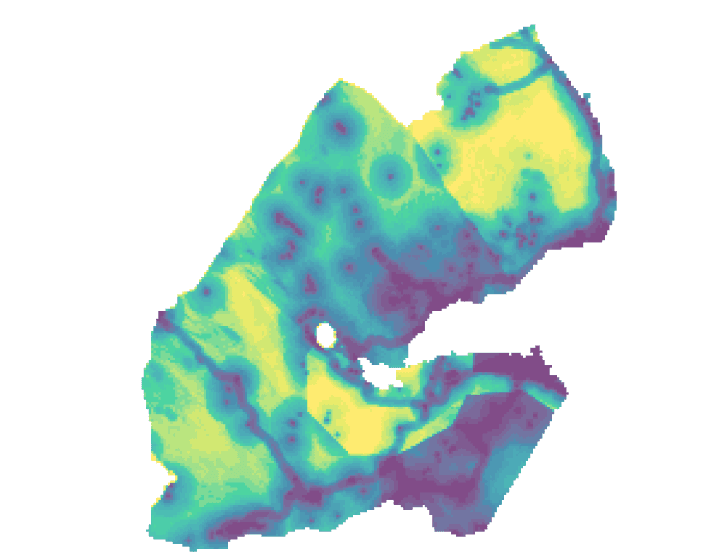
- This article will use WorldPop's population density dataset and walk through how to to map population density with R using data for Djibouti as an example.
- Keep in touch with the latest in the ML4EO field and explore the latest tutorials and webinars designed to help you work efficiently with geospatial data and cloud-native practices.
- This lesson teaches you how to build an interactive dashboard that allows users to find charging stations for electric vehicles in Canada.
- The ggplot2 R package does not natively support plotting raster data. This article presents a custom method for plotting RGB satellite imagery with ggplot2.