Actinia is an open source REST API for scalable, distributed, high performance processing of geographical data that mainly uses GRASS GIS for computational tasks. Learn more about it here.
- Google Earth Engine and BigQuery are both tools on Google Cloud Platform that allow you to interpret, analyze, and visualize geospatial data. This post demonstrates how data can be moved to BigQuery.
- This multi-page web app (source code included) demonstrates various interactive web apps created using streamlit and open-source mapping libraries, such as leafmap, geemap, pydeck, and kepler.gl.
- LEVIR-Ship is the first public tiny ship detection dataset specific to medium-resolution remote sensing images. Check it out here.
- tmap is an open-source R package for drawing thematic maps. The API is based on A Layered Grammar of Graphics and resembles the syntax of ggplot2, a popular R package for drawing charts.
- Dynamic World provides global, near real-time land cover data at a 10 meter resolution, giving an unprecedented level of detail about what's on the land and how it's being used.
- Check out this long list of resources to help you with ArcGIS development, APIs, SDKs, tools, and location services.
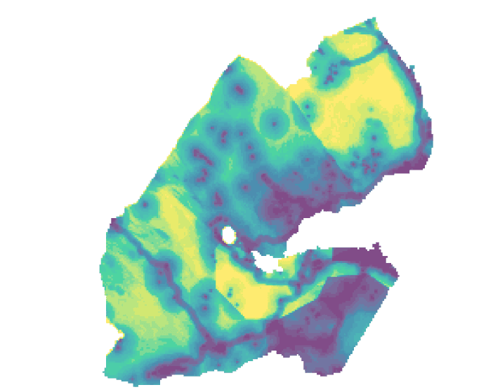
- This article will use WorldPop's population density dataset and walk through how to to map population density with R using data for Djibouti as an example.
- Felt is a live, editable map that anyone can use personally or professionally, aiming to make map-making approachable and fun. Learn more here.
- This demonstration highlights the new autoscaling capabilities for ArcGIS Enterprise that allow administrators to configure and deploy systems that respond to unexpected performance demands.