Read about new exciting cartographic features in QGIS and how they'll improve your maps here.
Archive: Qgis
- Watch this video tutorial to learn how to create 3D assets for QGIS in Blender.
- Check out this tutorial on how to visualize your Strava data in QGIS.
- This video presents 3 fast and easy methods how to load MapTiler maps to QGIS: using a QGIS plugin, setting up a WMTS server, and importing a geopackage or MBTiles directly.
- Here is an advanced tutorial on how to create 3D OpenStreetMap city models with QGIS and Aerialod.
- Kart is now available as a QGIS plugin. Work with version controlled data directly within your desktop GIS – see your data history, commit incremental changes and create and merge branches with ease.
- The MapFlow plugin for QGIS provides AI models for automatic feature extraction from satellite imagery, including building footprints, roads, fields, forest and construction sites.
- QGIS GeoNode plugin, that allows working with and managing GeoNode resources in QGIS, is now published in QGIS plugins repository.
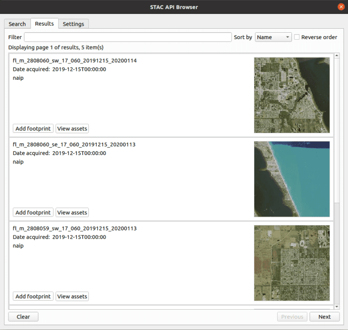
- You can now search and use any STAC API with QGIS. This plugin offers a comfortable way to browse the STAC API items and ability to add the STAC API assets as map layers into QGIS.
- Recent versions of QGIS support using the OGC API for Features as a vector data source. Learn how to publish spatial data with pg_featureserv using this protocol and add the layer to QGIS.